Facebook has recently announced that it will be providing location data to the disaster relief organizations for users in the affected areas. This will include the places where people will be escaping to. According to the company’s policy research manager, in the initial stages, the new disaster maps will be provided by Facebook to the UNICEF, World Food Program, and to the Red Cross and Red Crescent.
The company for this purpose will provide three kinds of information. The information will be provided from GPS and other location indicators whenever a user does just about anything. The location density maps will provide irregular latest estimations of where individuals are distributed. This will be them compared to the maps and measures taken earlier.

The Movement map will provide users with changed locations which would help the direct urgent resources to gather spots on ad hoc basis.
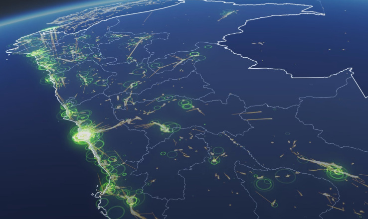
In the diagram above, the safety check map shows the clustering of people in an area where they have marked themselves safe. This will indicate the limits of a disaster’s effect in an area. This is an extremely good information for a person who is trying to find a safe ground, set up an emergency shelter and so on. there are still many questions that what kind of population movements will Facebook track? How would users know that their information is being used for the experimental purpose?etc. but we can assume that information can be used both for humanitarian and self-serving purposes.
Featured Image Credits: Facebook
News Via: Tech Crunch